Rights of way improvement plan 2020 to 2030

The Public Rights of Way and Access Network
A public right of way (PROW) is a path that anyone can legally use and enjoy on foot and sometimes using other means of travel.
In law, a public right of way is part of, and connects with, the wider highway network. Although they are mainly in the countryside, there are public rights of way in towns and villages too.
Read about the types of public right of way.
Buckinghamshire's rights of way
There are 2084 miles (3353 km) of public rights of way in Buckinghamshire:
- 81% are public footpaths
- around 18% are bridleways
- 1% are restricted byways and BOATs
All the public rights of way together are called ‘the public rights of way network’.
There are also some paths which are allowed by landowners but are not public rights of way. These are known as permissive paths.
The public rights of way network is an outstanding resource for everyone to access the natural environment. There are thousands of miles of paths which are free for everyone to use and which are always open.
Public rights of way maps
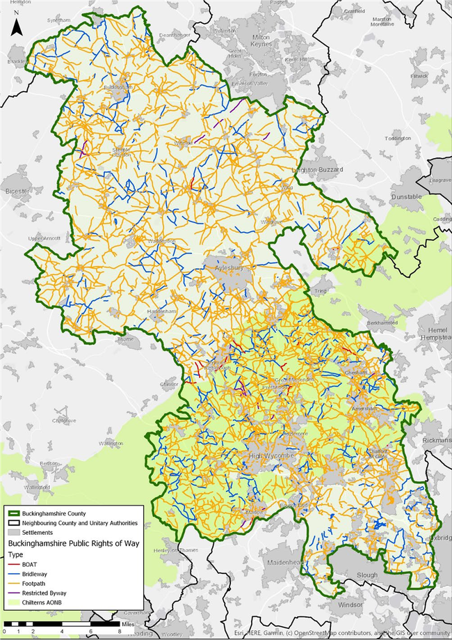
Public Rights of Way Network Map
You can also see our interactive Public rights of way map.
If you're looking at the map for legal purposes, you may want to purchase an extract of the definitive rights of way map.