The Buckinghamshire Greenway
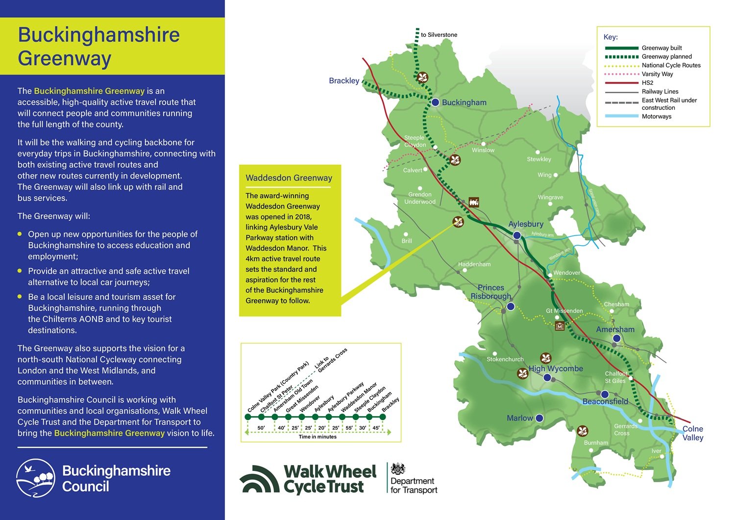
The Buckinghamshire Greenway is our vision for a continuous walking, wheeling and cycling route that goes through the length of Buckinghamshire (over 50 miles).
The route is being split into sections which will provide useful local links, create access to community amenities and connect to local public transport networks.
When complete, it will connect the entire county from the north (Silverstone) to the south (Colne Valley).
The routes
View a map of the overall Buckinghamshire Greenway (JPG, 424 KB)
View more about the individual routes:
- Waddesdon Greenway (from Waddesdon to Aylesbury Vale Parkway)
- Platinum Way (from Aylesbury town centre to Aylesbury Vale Parkway)
- St Peter's Greenway (from Berryfields to Buckingham Park)
- Misbourne Greenway (from Wendover to Great Missenden)
Future development
The way we're adding to the greenway enables us to build extensions to the different sections as we secure funding and consents for each section.
View more about how we're extending the Buckinghamshire Greenway.
How the greenway interacts with HS2 works
The northern section is linked to the delivery of HS2 because it intersects with it in several locations.
We've agreed with HS2 Ltd and the Department for Transport that the greenway should be incorporated into the HS2 design at these points.
Benefits of greenways and cycle routes
Creating the greenway contributes towards our main council priorities, including:
- responding to climate change
- improving health by reducing congestion and encouraging exercise
- boosting local tourism
The greenway is accessible for all users. This builds on Buckinghamshire’s heritage as the birthplace of the Paralympics.
Stay updated with developments
We are working with partners on some parts of the greenway, including the Department for Transport and The Chiltern Society.
Subscribe to the newsletters for updates on new or improved routes:
- complete the online form to subscribe to our Platinum Way newsletter